Tourist places in Nilgiris
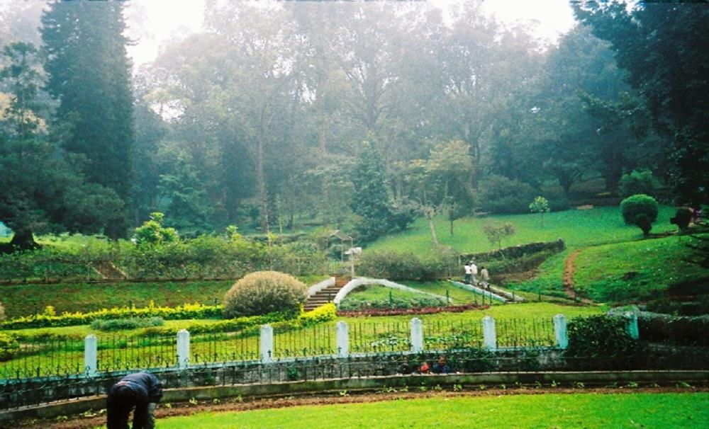
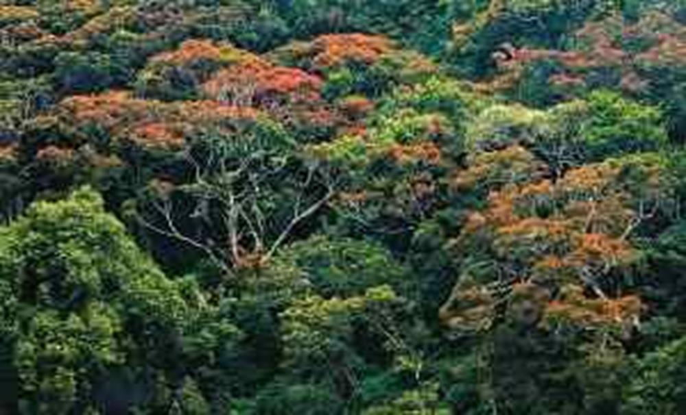
The Nilgiris District is one among 32 states in Tamil Nadu, India. In English the Nilgiris has translated as Blue Mountains. It is also the name given to a range of mountains widen across the division between the states of Tamil Nadu, Karnataka and Kerala. The Nilgiris Hills are part of a larger mountain chain known as the Western Ghats. Their highest point is the mountain of Doddabetta, height 2,633 meters. Headquarter of the district is Ooty or Udhagamandalam. According to Indian Census 2011, the Nilgiris district had a population of 7, 35,394 with a gender-ratio of 1,042 females for every 1,000 males. It is one of the highly attracted places for tourist all over the globe. Let's see important tourist places one by one.Government Botanical Garden
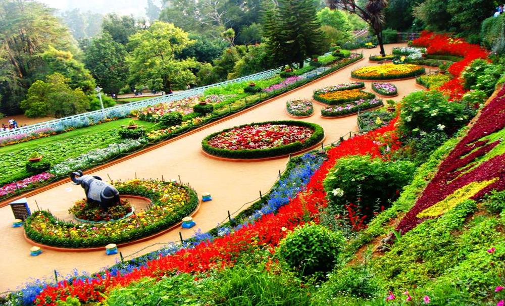
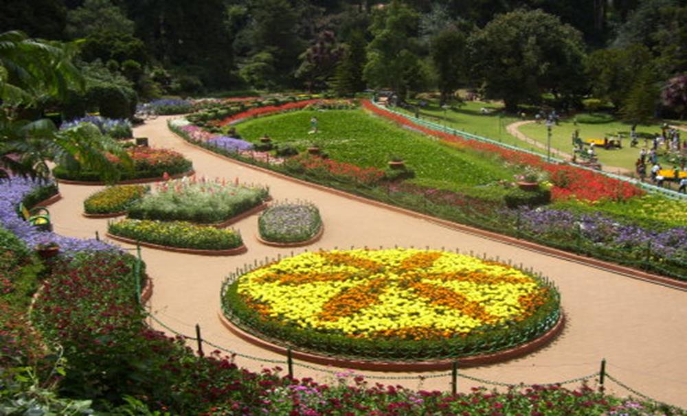
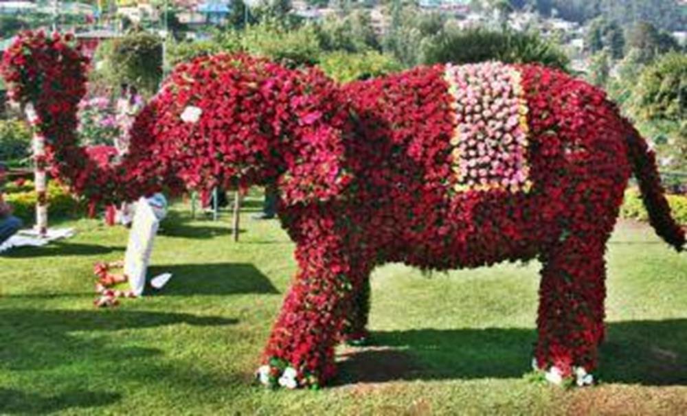
It was built out in 1897 by the Marquis of Tweedale and is widening over 55 acres. abundant green, well maintained lawns, rare trees species (like the cork tree which is doubtlessly the only such tree in India, the paper bark tree and the monkey puzzle tree-monkeys cannot climb this tree) here, a 20 million year old fossilized tree, an Italian-style garden flanking a clear pool, a vast assortment of flowering bushes and plants in countless hues (exotic and ornamental), leaf house with a vast variety of leafs and orchids, are some of the many highlights of this garden. A flower show along with an exhibition of exceptional plant species is held every year in month of May at this garden. This garden was maintained by the Tamil Nadu Government. This is one of the main attractions in Nilgiris district.
Centenary Rose Park
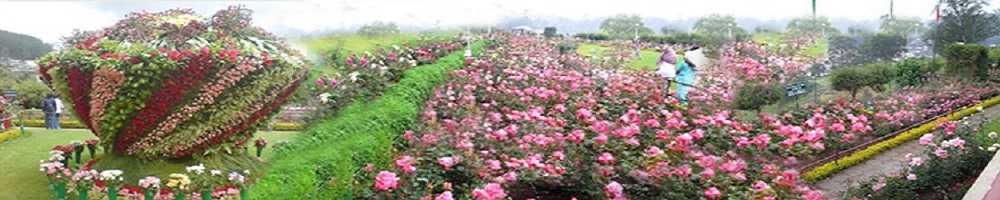
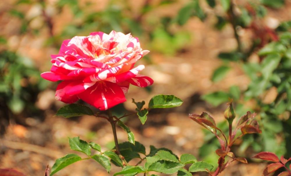
Centenary Rose Park is located in the heart of Ooty town; this garden has been wonderfully laid out in terraces with rose tunnels, pergolas and bowers with rose creepers. In order to commemorate the centenary Flower Show, the Rose Park was recognized at Vijayanagaram in Udhagamandalam flanking an area of 4 hectares in five terraces. Currently this garden has the largest collections of roses in the country like Hybrid Tea Roses, small rose, Floribunda, Ramblers, roses of unusual colors like black and green are some of the more than 3,000 varieties of roses that will mesmerize your senses. The Rose Garden is located in slopes of the Elk Hill. It has also received the award of Excellence for the best rose garden in entire south Asia from the International Rose society in 2006.
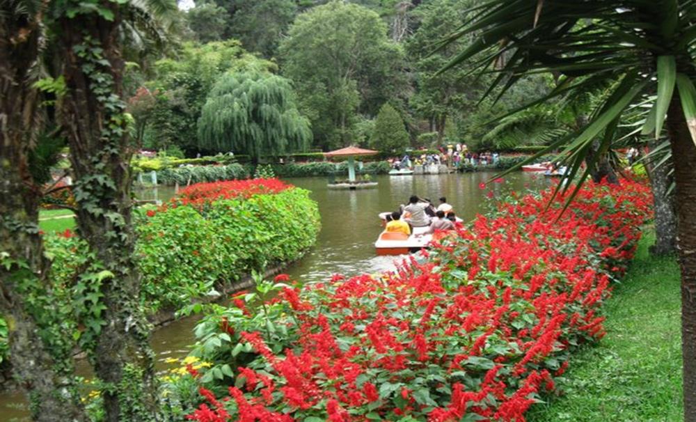
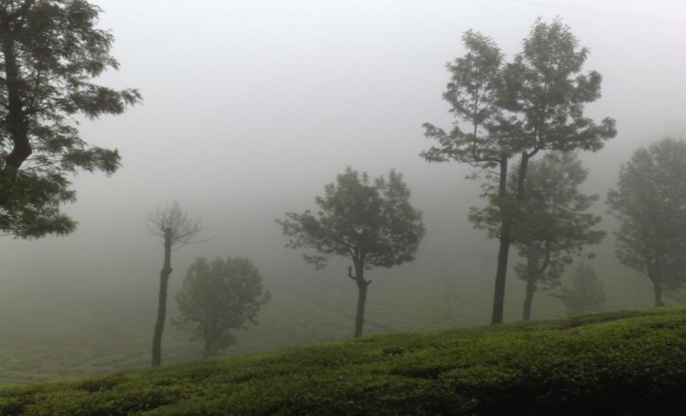
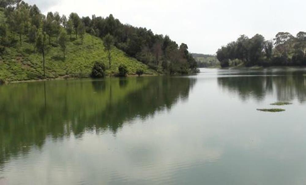
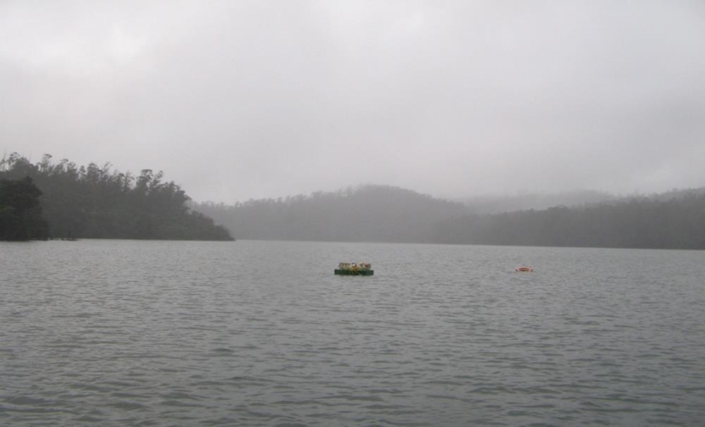
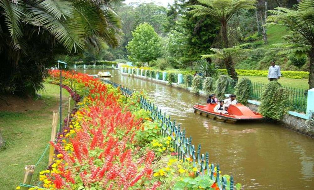
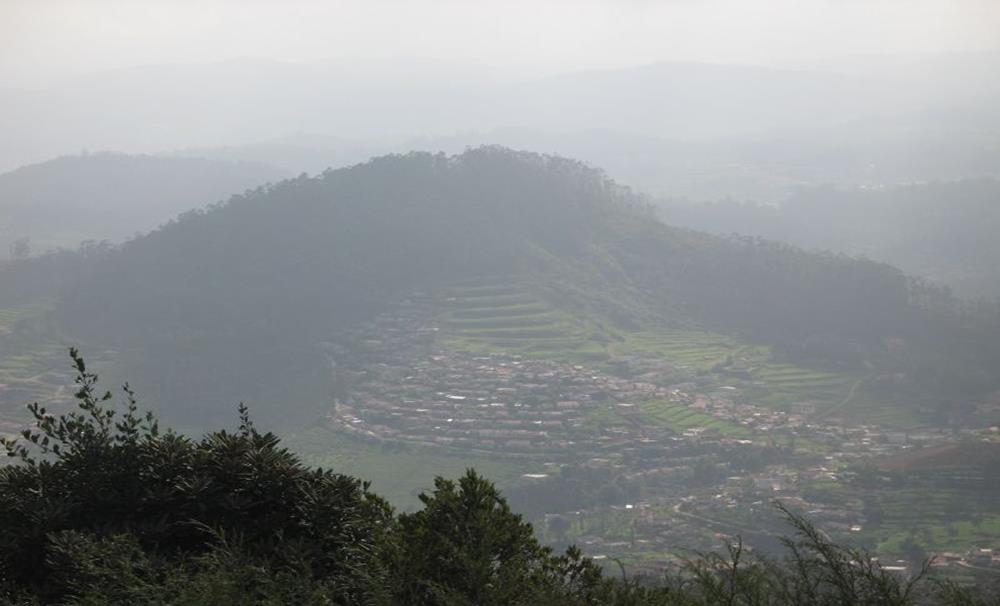
Ooty Lake
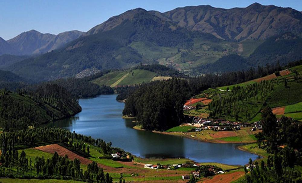
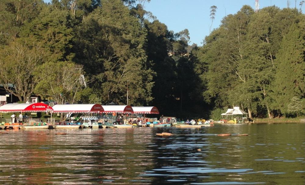
The Ooty Lake is the pleasure of the Blue Hills. It is the middle and intentional attraction. Mr. John Sullivan formed this artificial lake in the year 1824. It is located an area of 65 acres. The water flowing down mountain watercourses in the Ooty valley was dammed to form the lake. The lake became unfilled on three times when it breached its bund. The lake was initially envisioned to be used for spinning with ferryboats being used to transportable across the lake. It progressively shriveled from its unique size giving place to the current bus stand race course, and the lake park. The Tamil Nadu Tourism Development Corporation on behalf of the Tourism Department took the proprietorship of the lake in 1973, for providing boating amenities as a tourist magnetism.
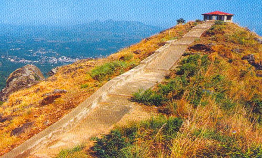
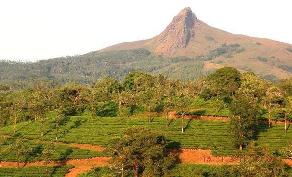
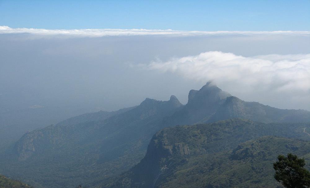
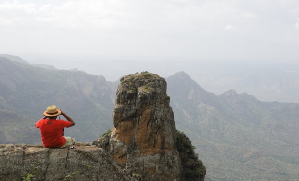
Doddabetta
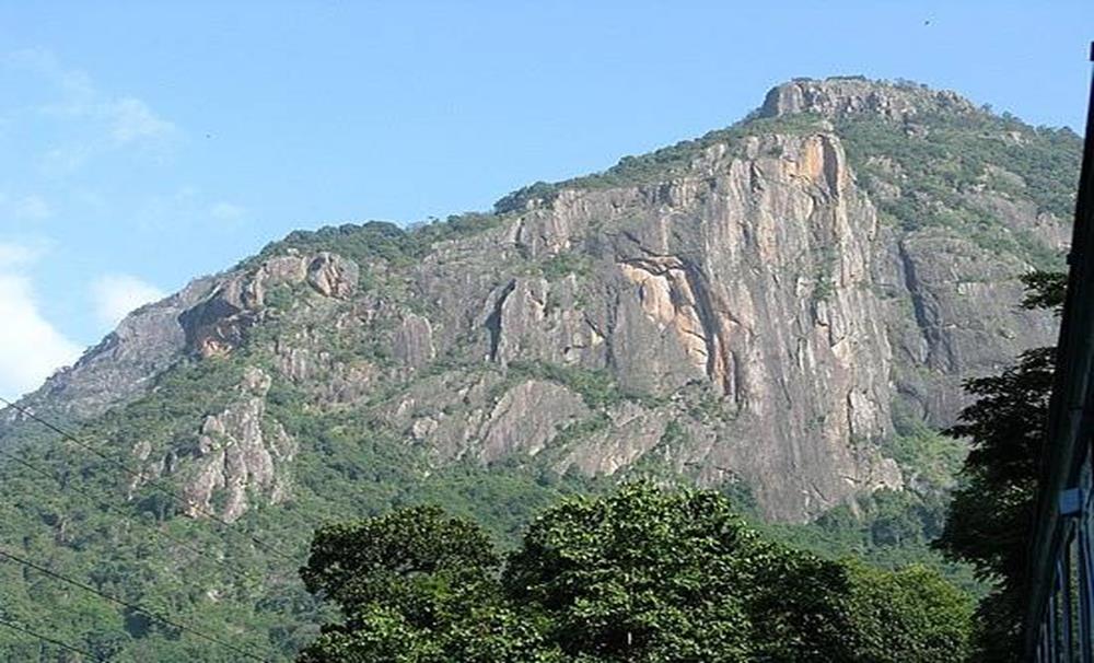
It is the highest Peak in the Tamil Nadu and 10 KMs away from Ooty Bus stand. It has 2,623 meters. The name Doddabetta accurately means 'Big mountain' in the Badugu Language, which is so in reality. It is at the connection of Western and Eastern Ghats and offer stunning vistas of Nilgiris Hills range. Here, there is telescope which is used to see panoramic view of the Nilgiris.
The Ootacamund Club
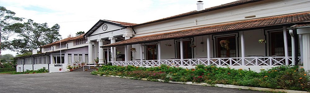
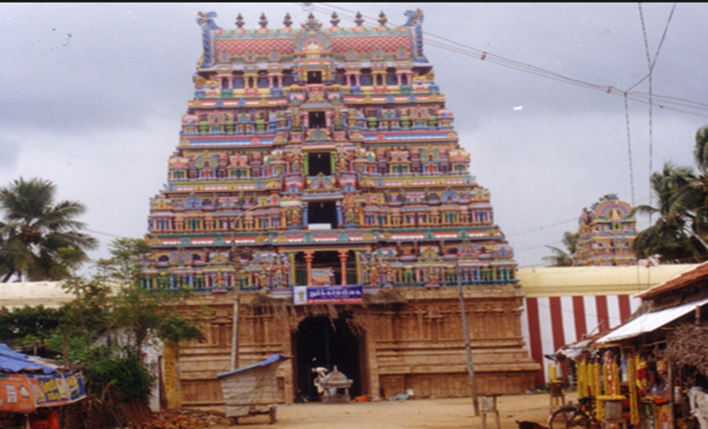
Ootacamund club ranks one of the leading clubs in the state of Tamil Nadu. It is located in the heart of the town at the base of the hill adjoining the St. Stephen’s Church. It is said that snooker was invented this club. Ootacamund (Ooty) was exposed by the British around 1819, and they gathered there, and as their numbers grew, so did the essential for a mutual conference ground, & thus the Ootacamund Club came into being in October 1841. The creator of the Club was a Captain Douglas who, composed with the 7 other officers of the Madras & Bombay Armies, formed the first committee, Lt. Col. C. D. Dun being the first President. Captain Douglas at first assumed the office of Secretary until the creation was resolutely opened & then handed over this office to Dr. R. Baikie MD MMS who, in evasion of other credentials, devoted most of his time & courtesy to it.
Raj Bhavan
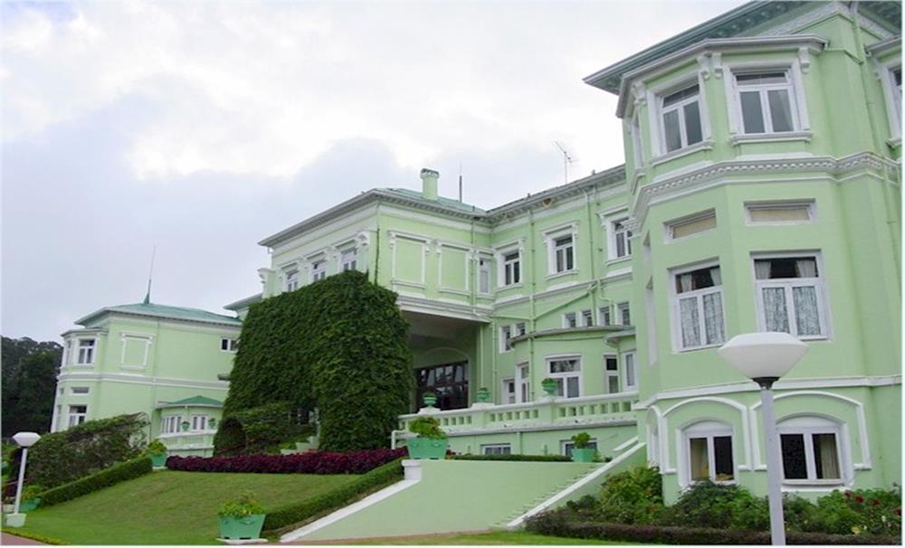
Government House (Raj Bhavan) is located on a ridge of the Western Slopes of Doddabetta on the suburbs of the South Eastern Quarter of Udhagamandalam. In the year 1876, the government was decided to purchase Upper Norwood and Lower Norwood, which fitted to the trustees of Lawrence Asylum and started efforts for the formation of the Government House at Ootacamund. The Duke of Buckingham, who started the purchase, took proprietorship of both the Upper and Lower Norwood and the Garden Cottage.
But afterward a single stay, the Governor was persuaded that the Upper Norwood was not a fit enduring place for the Governor. Rapidly after recurring to Madras, the Duke planned the building of a big two storied building which can come up with the money for whole accommodation for the family and deliver public welcome rooms. Amongst 1878 and 1881, various approximations were prepared and a final estimation for the construction of Government House at a cost of Rs.4,02,914/- was approved. But this estimation did not comprise the cost of equipping the building and hence a further complete estimation was prepared in July 1888 for an amount of Rs.7,79,150/-. Finally, the Government House was constructed at a cost of Rs.7,82,633/-.
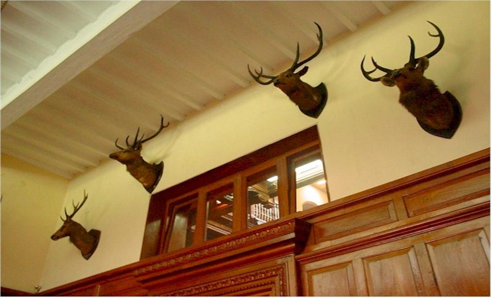
In the year 1899, a Ball room with an ante-room was added to the Government House and in 1904 electrical installation for the entire premises was accepted and installed. During the period of construction of the Government House, The Duke of Buckingham exist in at Upper Norwood and was constantly examining the work, changing the plans and making suggestions. Sir Arthur Havelock significantly improved the interior of the unique building particularly the very fine and handsome Ball room. After Independence, the Government House was retitled as Raj Bhavan.
Adam's Fountain
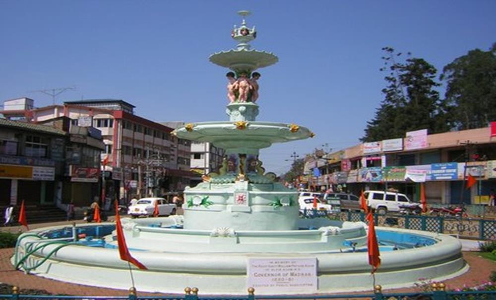
It is a memorial to a Governor who made himself in every way famous during a brief tenure of office decimated by his death at Ootacamand, was erected, by public subscription. It was at first intended to place it in front of the market, but it was consequently determined that the site in front of the Collector's Office was better, as being a more public place.
The Honey & Bee Museum
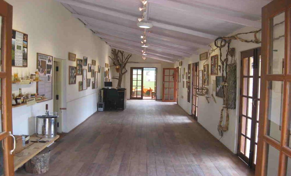
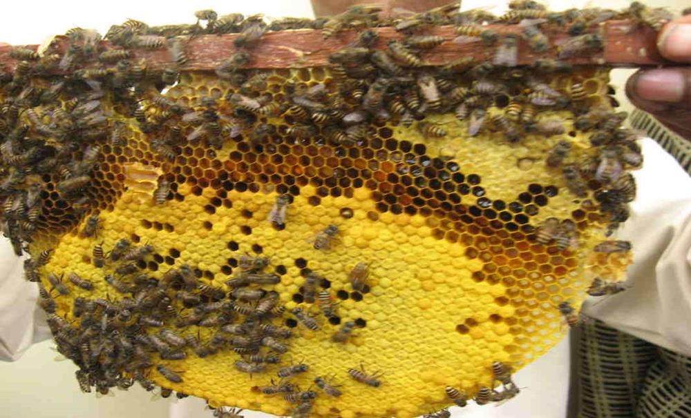
‘The Honey & Bee Museum’ is a novel project at Ooty by the NGO, Keystone Foundation. It shows or depicts information on indigenous honey bees and traditional indigenous tribal people who harvest them. The Bee Museum is first of its type focusing on traditional acquaintance and practices.
Ooty Radio Telescope
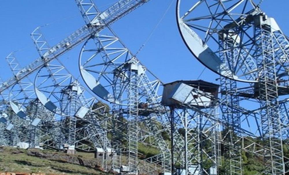
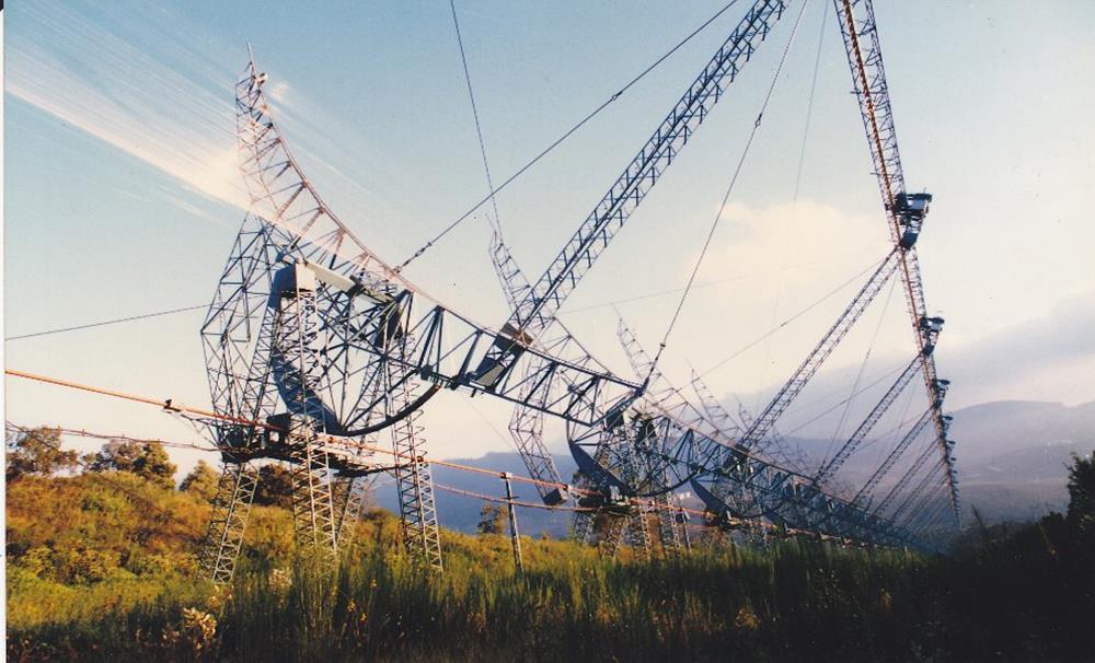
In Ooty Radio telescope has been installed at Muthorai which could be reached via, Fern hill on the Udhagamandalam - Avalanche road. This being the largest and biggest telescope in Asia was constructed between 1966 and 1968. It has generated with indigenous capabilities in antenna design and manufacture as an offshoot. The Radio Astronomy Centre (TIFR) is using the telescope for astronomical investigations.
Tribal Research Centre & Tribal Museum

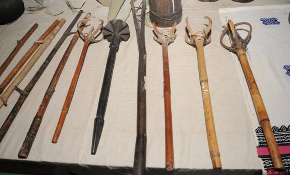
The Tribal Museum is running in the campus of Tribal Research Centre which is situated at Muthorai Palada, which is 10 Kilometers away from Ooty town. It depicts rare artifacts and photographs of prehistoric tribal groups of Tamil Nadu as well as Andaman and Nicobar Islands and promoted on the interests of Anthropological and Archaeological primitive human culture and heritage.
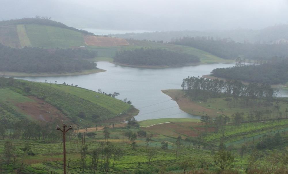
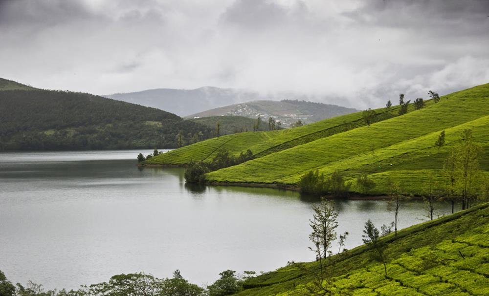
KAMARAJ SAGAR (Sandynallah Reservoir)
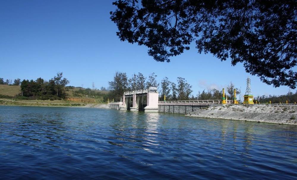
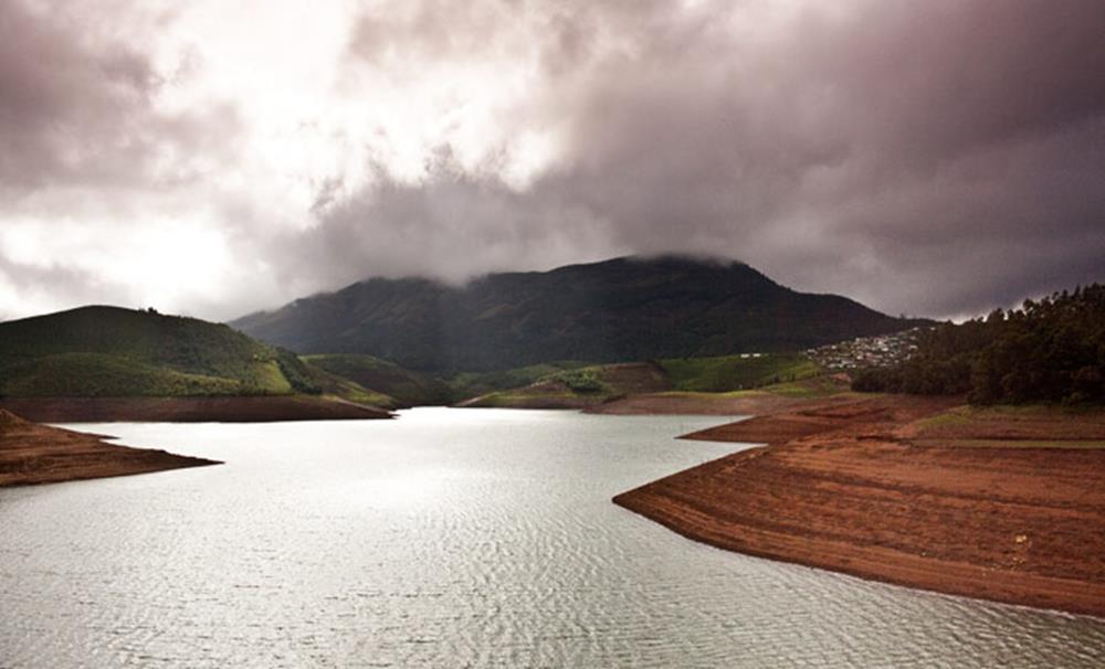
This Kamaraj Sagar Dam is a very good picnic spot and one can reach via Kandal amidst very ancient trees and green shrubs of various terrains. The Kamaraj Sagar Dam is not only famous as a picnic spot or for whaling, nevertheless, it has developed as a preferred rendezvous for nature enthusiasts and environmentalists who visit this Dam for study and research drive. Even Students in groups make regular trips to this Dam to detect and study its natural surroundings and habitat. The Kamaraj Sagar Dam is also a paradise for Bird watchers who frequent this Lake to observe occasional species of aquatic birds that breed and feed in this water reservoir. Filled with the prototypical natural beauty, this place is a must visit for all tourists on holiday in Ooty.
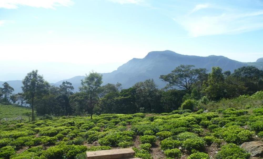
Glenmorgan
It is located 25 KMs away from North West of Ooty is located Glenmorgan which is very famous Tea estate. The Glenmorgan tea estate is one of the ancient estates of the place and it was there even before the Pykara Hydro Electricity scheme was taken up for implementation.
Avalanche
It is located 28 KMs away from Ooty town which is surrounded by undisturbed jungle and you have reached Avalanche. Avalanche Lake is a significant tourism terminus in the Nilgiris district. The lake is encircled by a progressing landscape with blooming flowers like magnolias, orchids and rhododendrons. Tourists can cross beside the lake through zigzagging paths around the lake. Tourists visiting the lake can also involve themselves in Trout fishing. A trout hatchery is well-known near the lake, from where visitor as can get fishing bars and other fishing fittings required for trout fishing. The lake is also used by tourists as a camp site wherein they pitch tents near the lake. Other tourist accomplishments in the area include pushing across the lake and hiking the nearby hilly regions like Upper Bhavani where there are thick forests and unharmed wild habitats.
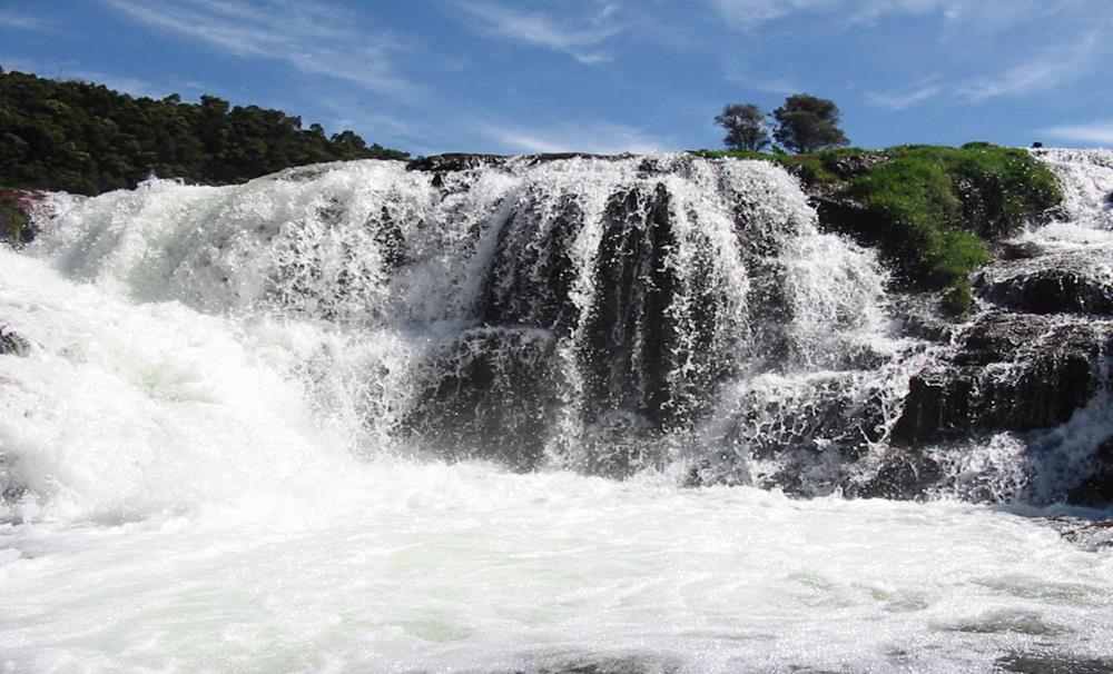
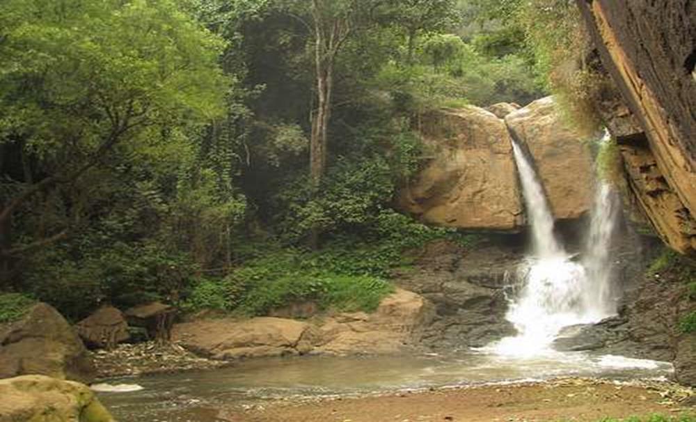
Kalkatti falls
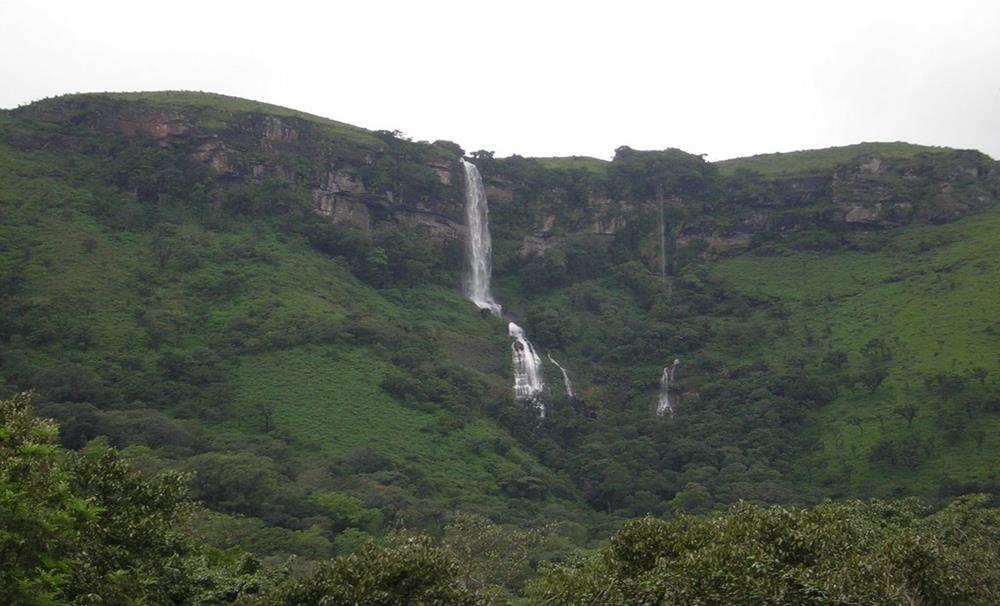
Kalhatty Falls is situated 13 Kilometers away from Ooty on Sigur Ghat Road. This is an exquisite picnic spot where the tallness of the falls is about 120 feet. Here, buses are available up to Kalhatty village on the 6th mile on Sigur Ghat road and one has to flank the next two miles by foot to reach the falls. Nevertheless, the falls is connected by a motor able road. It is perfect for persons fond of Hiking, Bird surveillance and Trekking etc.
Ketti Valley view
This view point is situated 7 Kilometers from Ooty on the Ooty – Coonoor Road. This valley is one of the largest and biggest valleys in the globe and extends from the plains of Coimbatore to the Mysore plateau. Ketti is a small town nestled in a big valley of the same name. It is situated in the Nilgiris District of Tamil Nadu State, South India and is a Revenue Village of Coonoor Taluk. Upper Ketti is another village called Yellanahalli, which is situated on the main Coonoor to Ooty road. This is the location of Needle Industries Pvt. India Ltd the manufacturers of the globally branded Pony Needles.
Pykara
The Pykara is the largest river in the District. It is deemed very holy by the Todas. The Pykara River rises at Mukurthi peak. It flows through hilly tract, particularly keeping to North and turns to West after reaching the Plateau's edge. It is located 21 Kilometers away from Ooty.
Coonoor Sims Park
It is an unusual park-cum-botanical garden was developed around the natural contours of the land more than a hundred years ago. It is located in Coonoor. Sim’s park and the Botanical Garden are to gather from the largest repository of temperate plants in India and an important destination for Botanists. Sim’s Park is the location for the yearly vegetable and fruit exhibition.
Lamb's rock
Lamb's rock is maybe the most preferred and favorite place for picnic parties near Coonoor Taluk. It is located in Burliar village and is 8 Kilometers away from Coonoor. Lamb's Rock is an eco-sensitive and comprehensive resort built in Coonoor, which is an entry to nature. Lamb's Rock situated in the Nilgiris, dodging the natural rain forest on side. Lamb's rock is an exceptional picnic spot near Coonoor which is 6 Kilometers away from the Coonoor Railway station. It is a point on the way to Dolphin's Nose. It was named afterward the man Captain Lamb who tried in intense to open a path to that specific point.
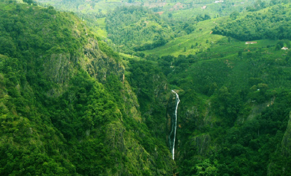
Dolphin’s Nose Viewpoint
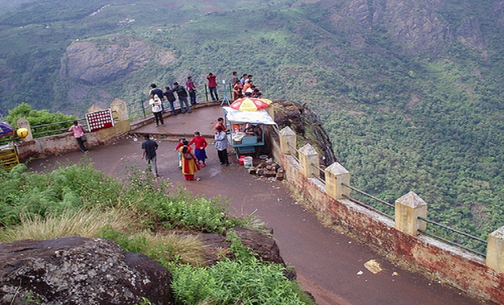
Dolphin's Nose Viewpoint is very significant tourist spot in Coonoor, The Nilgiris District, Tamil Nadu. Dolphin's Nose is well over 1,000 feet above sea level, 10 km from Coonoor and is a remarkable spot to visit. The tip of the peak look like a dolphin's nose, henceforth the name is Dolphin's Nose. It is a massive rock formation that is completely unique. There are enormous ravines found both to the left and right of Dolphin's Nose and there is a view of inspiring Catherine Falls with its continuing stream several thousand meters below which is situated a relatively short distance away opposite of the Dolphin's Nose.
Law's falls
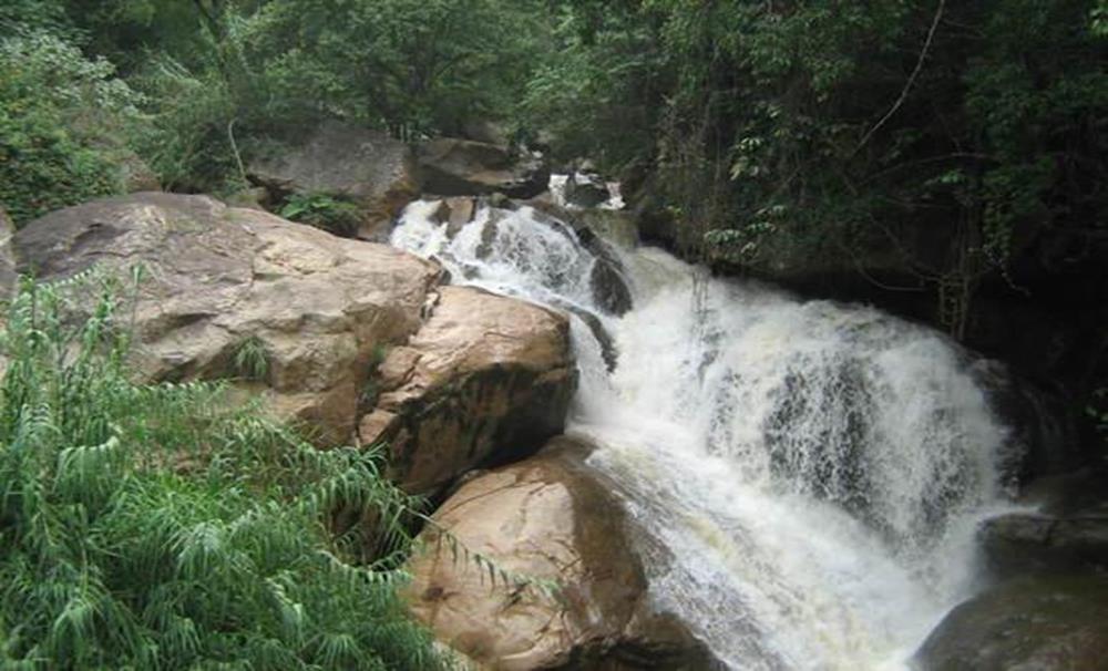
The Law's falls which is named after Col. Law, who traced and mainly constructed the new Coonoor Ghat, is a attractive flow on the Coonoor river near its junction with the Mettupalayam Ghat road. This small & pretty water fall attracts huge crowd, especially during post monsoons. Since this place is close to main road, it does not need much walk/trek. One can enjoy the force of the water at bottom of the falls. The place is rocky and slippery. Height of the falls is about 30 feet through multiple cascades.
Coonoor-The Droog
It is located 17 Kilometers away from Coonoor. One has to go up to Nonesuch Estate and trek down for about 4 Kilometers. There is a a ruined fort of which it was said that Tippu Sultan used this fort as an station. The peak stands at an altitude of about 2,000 meters, and directly overlooks the plains. It is one of the important historical places of Tamil Nadu.
Coonoor-Lady Cannings seat
It is situated 8 Kilometers away from Coonoor bus stand. It maybe the loveliest point in the heart of the woods. Lady Canning means, wife of the Viceroy was fond of this spot, which commands a picturesque view of the many tea estates, Lamptons Peak, Droog, Lambs Rock etc.
Gudalur
Ooty, Coonoor and kothagiri lies on the upper plateau of Nilgiris and Gudalur lies in the lower Plateau. It is the home of Taluk and lies about nearly 51 Kilometers, West of Udhagamandalam below the Ghats at an altitude of 1,180 meters above M.S.S. on the way to Mysore.
Needle Rock point
It is located 8 Kilometers away from Gudalur to Ooty road, this view gives 360 degree view. Here, a picturesque view of the Mudumalai Wildlife Sanctuary and Gudalur town far below, is will be visible from this view point. The Needle Rock Viewpoint is also called as the Needle Hill View point and stands amongst Pykara and Gudalur. It is normal method for tourist taxis to cover Pykara first and then drive you to this view point as is falls en way to other tourist spots everywhere Ooty. From Pykara, you also walk along the Ooty – Mysore Road to arrive at a forest area opening. Just before the forest, you will notice a small village named Gudalur and it is between Pykara and Gudalur that the Needle Rock View point is located.
Frog hill view point
It is located 12 Kilometers away on Gudalur-Ooty road. From here you can see Frog outline of a Hill view. Among many unique spots to visit, Frog Peak View Point is the most well-known spot close to Gudalur. It could be helpfully gone by while downward from Gudalur to Ooty. Frog slope is one of the prodigious hillocks close to Ooty. At the point when seen from a separation it shows up like a frog, subsequently it is commonly known as frog Hill View Point.
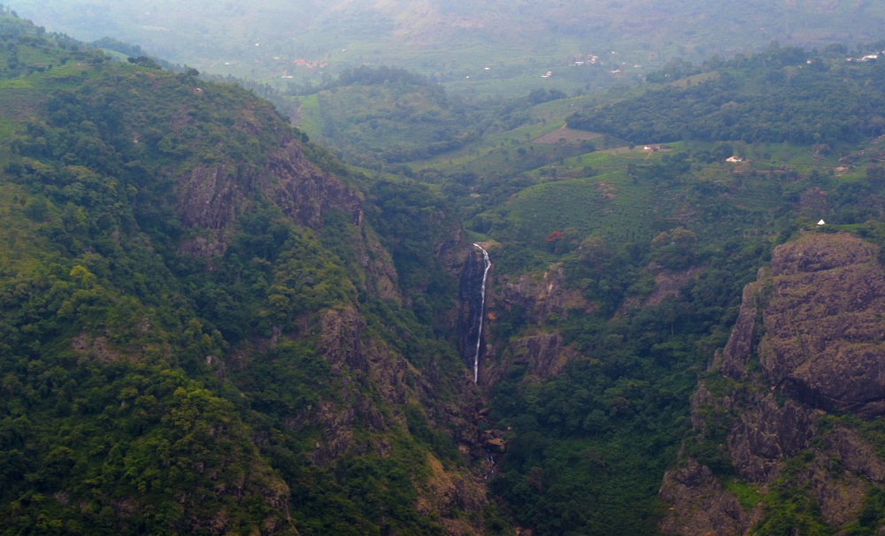
Kotagiri-Catherine Falls
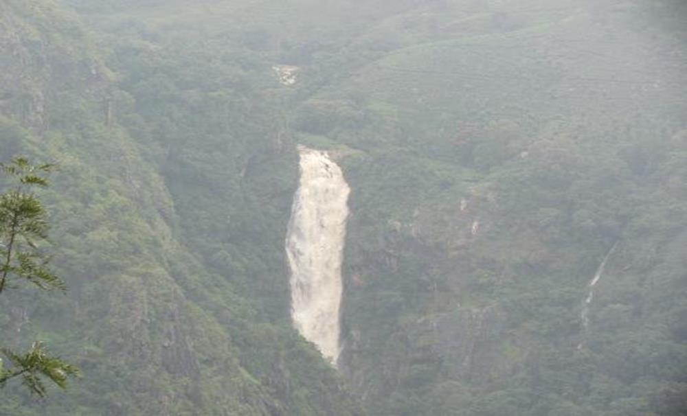
It is located 8 Kilometers away from Kotagiri, named after Catherine, the wife of Mr. M. D. Cockburn. This is a second highest falls in Nilgiris which flows from 250 feet. Catherine Falls is a double-cascaded waterfall situated in Kotagiri, The Nilgiris District, Tamil Nadu, and it is also a main tourist spot in Kotagiri, situated on the Mettupalayam road branching off at Aravenu. The upper fall drops to the floor, and is the second highest in the Nilgiri Mountains. The waters from the upper watercourse of the Kallar River are traversed by the imperceptible Mettupalayam-Ooty road beyond the mountains in the south-west. The height of water falls is about 250 ft. Catherine Falls is named after the wife of M.D. Cockburn, whispered to have introduced the coffee plantation to Kotagiri. The native name of the Catherine Falls is ‘Geddhehaada Halla’ meaning "Foothills Dale River". It can clearly been seen from the top of Dolphin's Nose if seeing the whole waterfall as one total dimple is what you are looking for.
Kotagiri-Kodanad view point
Kodanad is a small village which is located 18 Kilometers away from the East of Kotagiri on the Eastern edges of Nilgiris. The enormous valley dips down from feet to the level of plains and rises again in the opposite to the level of Mysore plateau.
Kotagiri-Longwood shola
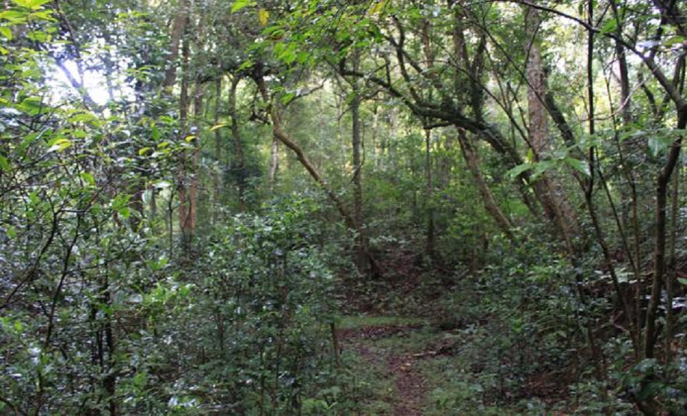
It is only the major pocket of natural shola forest which is left in the instant vicinity of Kotagiri in the Nilgiris. It is an integral part of the very fragile Nilgiris eco-system flanking an area of 116 hectares. So, the preservation of this forest is very foremost important thing. It plays a vital role in Kotagiri's microclimate, attracting and regulating rainfall. There is a very charming trekking path, which goes through this serene shola.
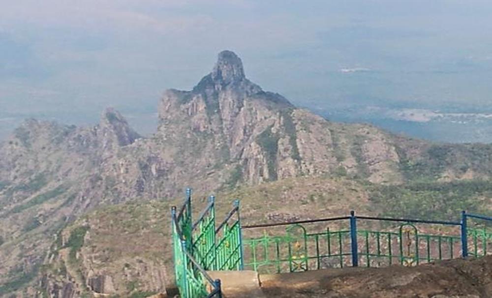
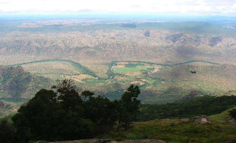
Rangasamy Peak
It is a narrowed peak at a height of 5855 feet above MSL and is the most sacred hill on the plateau. According to Hindu Legend says that Lord Rangasamy used to live at Karamadai in Coimbatore district on the plains but quarreled with his wife, came to live alone here.
Mudumalai Tiger Reserve and National park
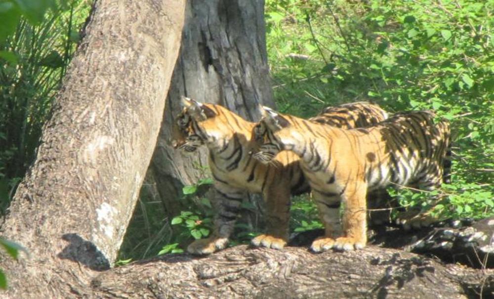
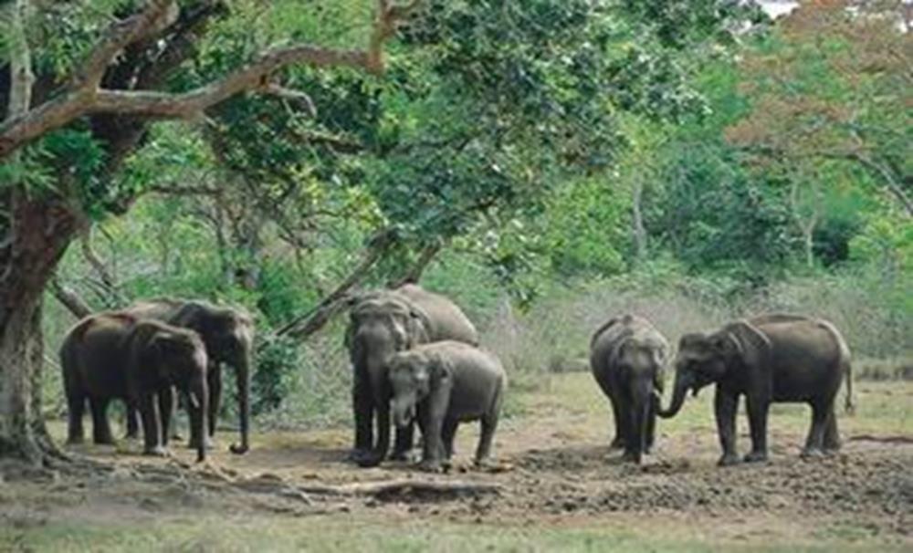
This is the first Sanctuary to be set up in India and forms part of the Jawaharlal Nehru National Park. It is situated 36 Kilometers away from Ooty from Kalhatty and 67 Kilometers away from Gudalur. It is 91 Kilometers away from Mysore, Karnataka. It covers an area of 321 Sq. Kilometers in the junction of the three states of Tamil Nadu, Karnataka, and Kerala. The altitude is 1,140 meters. It is rich in wildlife, like Tiger, Gaur, Elephants, Panther, Barking Deer, Spotted Deer, Porcupine, Wild Boar etc. and some of the reptiles like python, lizards etc.
Mukurthi National Park and Peak
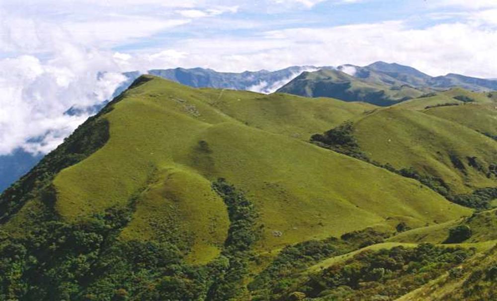
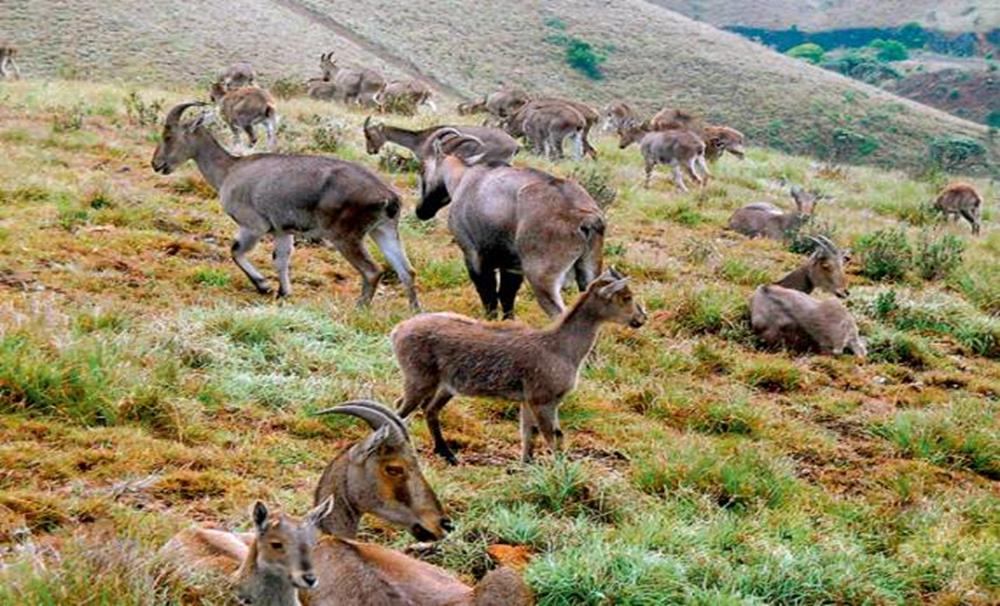
Mukurthi National Park is another major magnetism of the Nilgiris. It is situated on the south eastern corner of the Nilgiris Plateau. This area contains a viable population of Nilgiris Tahr (Hermitragus hilocrius). It is located 27 Kilometers away from Ooty. Here, the Mukurthi peak is surely the most notable height of the Nilgiris. It stands 8,380 feet above the sea level and it is one of the most magnificent views to be seen in India.
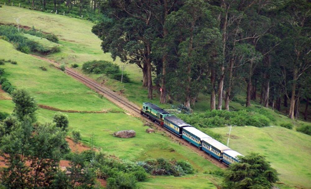
The Nilgiri Mountain Rail
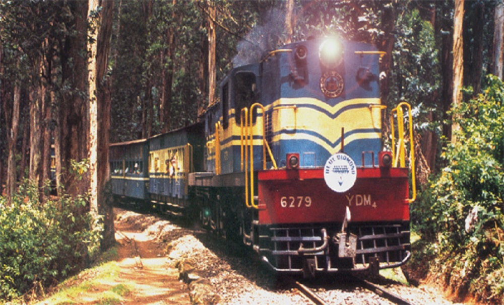
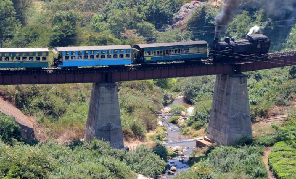
The Nilgiri Mountain Railway is a railway in Tamil Nadu, India, built by the British in the year 1908, and was originally operated by the Madras Railway. The railway still relies on its convoy of steam trains. NMR comes under the authority of the newly formed Salem Division. In July 2005, UNESCO added the Nilgiri Mountain Railway as an extension to the World Heritage Site of Darjeeling Himalayan Railway, the site then became known as "Mountain Railways of India. After it gratified the necessary criteria, thus forcing relinquishment of the modernization plans. For the past numerous years’ diesel locomotives have taken over from steam on the section between Coonoor and Udhagamandalam. Local people and tourists have led a demand for steam locos to once again tow this section.